Space42 Conducts Europe’s First Licensed HAPS Flight
Mira Aerospace, the High Altitude Platform Systems (HAPS) subsidiary of Space42 (ADX: SPACE42), the UAE-based AI-powered SpaceTech company, has conducted the first HAPS flight after obtaining civilian operational approval, in Europe. Executed by Mira Aerospace’s ApusNeo18 HAPS model for Telespazio Ibérica, part of the Leonardo group, the flight demonstrates how HAPS can safely operate and deliver real-time intelligence for critical environmental monitoring operations.
Khaled Al Marzooqi, CEO of Mira Aerospace, Space42, said, “Mira Aerospace’s role in Europe’s first HAPS flight with a civilian operational approval, reflects international momentum behind Space42’s strategy to become the preferred partner for premium geospatial intelligence. In wildfire response, HAPS offer the agility, persistence, and precision to produce a comprehensive, real-time view of moving fire fronts. The flight for Telespazio Ibérica shows how our systems provide commercial value through AI-enabled data, to governments and first responders, while improving decision-making, accelerating critical emergency response times, and reducing operational costs.”
Carlos Fernández de la Peña, CEO of Telespazio Ibérica, stated: “With the first flight, we have taken a major step that places the project on a new level. Not only have we secured these authorizations after a long and complex process, but we are also demonstrating our company’s technological capabilities in monitoring, controlling, and combating sixth-generation wildfires, which have proven extremely devastating in recent years.”
HAPS for wildfire response
The mission is part of the ISSEC program, a joint venture between Telespazio Ibérica and Pegasus Aero Group, which focuses on developing Spain’s wildfire-response infrastructure. HAPS offer satellite-like persistence with aircraft-level flexibility at lower operational costs. Its ability to transmit high-resolution electro-optical and infrared imagery in real time makes it well-suited for emergency management, environmental monitoring, and national infrastructure protection.
The data collected in the coming weeks will lay the foundation for future stratospheric services and help determine the extent of operational value of Mira Aerospace’s platforms for civil-protection missions.
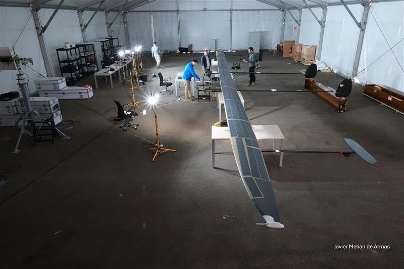
Flight operations
ApusNeo18 took flight on Friday, December 12, 2025, from the spaceport located at the Fuerteventura Technology Park, the first of its kind facility in Europe. With an 18-meter wingspan, 12-meter length, and weighing just over 45 kilograms, the aircraft climbed to 2,000 feet. In the coming days, it will fly over Gran Canaria to monitor the territory and capture information for wildfire prevention and management.
In the initial phase, operations will proceed through segmented flight stages, allowing progressive validation of each segment. These missions will gradually increase their altitude to 16,000 feet and extend their duration, with anticipated flights of up to 48 hours.